Showing posts with label Met Council. Show all posts

2019-01-02

Reasons for Leaving the Met Council Chair, Ranked

By popular request, a brief ranking of reasons for leaving the Met Council Chair position over the years.

[Note: I did not include Council chairs who were not reappointed at the beginning of a Gubernatorial term (e.g. Peter Bell, Ted Mondale).]


7. Gerald Isaacs, 1984

Left because he was: “on a committee promoting Sen. John Glenn’s presidential aspirations, [which was] interpreted as a violation of Perpich’s political activity guidelines.”

Yikes. Glenn did not even do well, IIRC.


6. Mary Anderson, 1992

Dismissed by Gov. Carlson, who wanted the Met Council to be *MORE ACTIVE* in the affairs of local government in order to cut spending.

[Note: how times have changed for the Minnesota Republican Party.]

Seems like this was not really Anderson's fault, but this is not the ideal way to go.


5. Adam Duininck, 2017

Left to become Head of Government Affairs for regional Carpenter’s Union.

OK, but hard to see this as a more important job. Surely less stressful...


4. Alene Tchourumroff, 2018

Left to take a job at the Minneapolis Federal Reserve as a senior Vice President of something.

Seems like a cool gig, I guess.


3. Sandra Gardebring, 1986

Left to become head of Department of Human Services, when that appointment opened up in the Perpich administration

Kind of a big deal to run that agency. She later became a Minnesota Supreme Court justice!


2. Sue Haigh 2014 

Wanted to focus on her "other job" running Habitat for Humanity.

Surely a worthy cause. Pay for the Chair position more than doubled right after she left.


1. Al Hofstede 1973

Decided to run for mayor of Minneapolis.

And he won, too.


2016-08-29

Dakota County Shoots Future in Foot in War of the CWADS

Unless you’re a transit nerd, this summer’s news about Dakota County leaving CTIB probably seemed like “inside baseball.” (Most people’s response: “Ummm, see-what now?”) The story relies on knowledge about the intricate and compromised way that transit funding works in the Twin Cities. Even though I’ve spent years talking with people about it, I still don’t quite understand all the details (e.g. the exact differences between the CTIB and the TAB).

A quick explainer. Even though we have a seven-county metro area, shaped by the Met Council, lots of our newly-constructed transit is funded through the allocation of a five-county small sales tax governed by a separate board called the Counties Transit Improvement Board (or CTIB). That’s a big part of where “local match” money for projects like the Green and Blue LRT lines and their extensions, the Northstar rail, and other projects comes from.

The CTIB arrangement is voluntary. Counties sign up to tax themselves in exchange for some control over how the money gets spent. This delicate money pooling arrangement (on the board, each county gets two members, and the Met Council gets one) leads to challenges because both the majority of actually-existing tax revenues and transit usage exists in only two counties (Hennepin and Ramsey). Meanwhile, the remaining three counties (Anoka, Washington, and Dakota) have huge challenges implementing transit because of their existing land use patterns. (See also, the CWADS: Carver, Washington, Anoka, Dakota, and Scott...) This geographic imbalance of transit potential, transit need, and transit expectations helps explain how and why some of our decisions are so messy.

The existing balance changed this summer when (#brexit-style) Dakota County staged a mini-revolt against the CTIB system by officially withdrawing from the 5-county agreement. ("DaCexit?")

Here’s a bit from the June Star Tribune story on the decision:
Dakota County is planning to leave the regional body that funds transit projects across the Twin Cities.

The County Board voted in committee Tuesday to take steps to withdraw from the Counties Transit Improvement Board (CTIB), which pools tax money for projects such as light rail and bus rapid transit (BRT).

County leaders have raised concerns about whether membership is worth it. Though CTIB dollars have funded local projects including the Red Line BRT, a lot of the tax money that Dakota County contributes goes toward projects in other counties.

“I think we could do so much more if we kept it ourselves,” Commissioner Liz Workman said.

There you have it. Get ready for even more heavily subsidized opt-out buses bigger park and rides or something.


[Dakota County affordable housing is only in a few spots.]
Dakota County Geography 101

The decision to leave is a long time coming for Dakota County, which has teetered for decades on a knife’s edge between urban and exurban views of what the Twin Cities should look like. I should know, I grew up in Dakota County and still hang out there all the time. (Hi mom!)

For one thing, Dakota County is huge. It’s the same size as Hennepin County, i.e. massive, stretching from the edge of Saint Paul deep through farm country and all the way to the Northfield border. At the same time, it’s not very dense. The entire county population is about 350,000 people; compare that to Hennepin County’s 1.5 million. Its most urban (read: affordable, somewhat walkable) parts are first-ring suburbs like West Saint Paul, South Saint Paul, and small cities like Hastings. And then there’s a huge swath of second-ring cul-de-sac burbs like Apple Valley, Eagan, Burnsville, Inver Grove Heights, and more. Finally you get some third-ring and exurban places like Lakeville, Rosemount, and Farmington, where it’s not uncommon to have brand new homes literally planted in cornfields. This sprawling geography makes coherent policy a challenging political proposition.

Despite claims to victimhood from Dakota County Commissioners, Dakota County leaders are responsible for their own transit failure. The County, especially the Northern border areas, has a lot of opportunity for transit oriented development. But without leadership, they’re abandoning a walkable future and, years from now, Dakota County will be much worse off because of it.

[Annapolis Street may not look like much, but this is the border between two counties.]

The Classic Case of West Saint Paul and Robert Street

[The strip.]
The first-ring suburb of West Saint Paul offers the best example of how Dakota County transit politics plays out. West Saint Paul is a small square suburban city of about 20,000 people running from Annapolis Street, along Highway 52, South almost to Highway 110 and East over to Mendota Heights. The city is most famous for Robert Street, a massive post-war STROAD if there ever was one, a wide 50s strip lined today with automobile retail of every possible variety. Growing up, Robert Street is where our family went to shop. a wide 5-lane undivided road lined with parking lots and drive-thrus: Payless Shoes, Signal Hills Mall (B. Daltons, Herberger’s), Chuck E. Cheese, Ponderosa Steakhouse, the WSP library, Carbone’s, Cina 5 Theater, Granny Donuts, the non-super Target, the McDonald’s Playland on the hill, etc.

These days, I rarely visit, because I don’t like big box stores and the street is almost unbikeable. But if anything, in the intervening years the street has only become more of an automobile strip, adding things like B-dubs, Starbuxes, a massive WalMart, a SuperTarget, little places with great Latin American food, and every other suburban chain store you can think of (including a 5-8 Club franchise owned by a woman who was in my graduating high school class).

The other thing you’ll notice if you go to Robert Street these days is the construction. The street is being completely re-done, after much planning, to add medians and nicer ADA sidewalks. It was an expensive, multi-year project. When there was an election during the construction period, an anti-tax candidate  emerged to run against the road construction project, Scott Walker-style, under the “they’re wasting our money with sidewalks” platform. He channeled people’s frustration over road construction and taxes, and got himself elected mayor.

Since then, Meisinger has taken opportunities to lambast street amenities like sidewalks. And one of the consequences of Meisinger’s election is that ongoing planning for transit on Robert Street has been killed (as I was told) “pending land use planning changes in West Saint Paul.” It’s kind of like Scott Walker in Wisconsin, where transit or rail projects are waiting a magical political sea-change.

[Changes to school district composition over 30 years.]
Ignoring Suburban Poverty

West Saint Paul’s political situation is revealing because the city is in the midst of rapid change. When I went to high school here in the 1990s, the graduating class was just about all white; today, according to my old English teacher, it’s now 1/3 students of color and growing more so every year. Similarly, the city demographics are rapidly changing and becoming more diverse, even as much of the housing stock and infrastructure (like Robert Street) ages to the point of obsolescence.

West Saint Paul is also an exemplar of another more troubling dynamic, where race, poverty and housing form a distinct suburban pattern. This pattern becomes very noticeable for me when, from time to time, usually after the #62 bus service ends, I ride the #68 bus running down Robert Street South from Downtown. Even late at night, the bus is full of people of color riding to and from work and to homes in West Saint Paul or points further South.

In most post-war suburbs, especially first-ring cities like West Saint Paul, the bulk of the affordable housing is concentrated along narrow corridors of land near freeways. (See also, these two examples.) For many families, these slender swaths of apartment buildings represent the only places where they can find decent housing and good schools, especially in the crunched low-to-middle range of rental property. But moving into these suburban areas comes with a cost, as the sidewalks and transit in places like West Saint Paul are almost always lacking. And forget about riding a bicycle! It’s all but impossible (though people somehow do it anyway).

As they age and the homes get older and less fashionable, and as infrastructure like Robert Street comes due for expensive re-construction, cities like West Saint Paul (or many first-ring suburbs) get caught in an economic and political vice: struggling and/or aging middle-class homeowners decrying taxes and economic marginalization on one hand, rising costs and decreasing tax-base on the other. Cities can get caught within a vicious cycle where disinvestment threatens to spiral out of control. The end point is a place like Ferguson, Missouri, though (thankfully) nowhere in the Twin Cities is yet near that level of economic marginalization.

Quality transit investments are one of the few things that might help cities like West Saint Paul, catalyzing density that gives cities like these a chance to balance the tax books, creating mixed-use transit-oriented development that is in hot demand. Without it, the bottom line looks bleak.

Instead, the end result is that West Saint Paul, Dakota County, and the region will become more fragmented and polarized. For wealthier enclaves like Lakeville, the politics of urban separatism is appealing. Meanwhile, the transit riders close to the border will continue to struggle.


[South Robert Street wasteland.]

The Saint Paul Sacrifice

Living on Saint Paul’s West Side, a half-mile from the County line, it’s maddening to think that there will be no regional transit cooperation coming from the Dakota County side of the border. In Saint Paul proper, it’s no exaggeration to say that South Robert Street is one of the worst streets I’ve ever had the displeasure of experiencing. The sidewalk is abominable, narrow, and abuts the curb. There are no bike lanes, and the five lanes (!) of traffic move at very high speeds for a supposedly urban area. The absolute dignity vacuum here is one reason why the street is lined with half-century-old vacant lots, dilapidated surface parking, and abandoned commercial buildings the likes of which are rarely seen outside of ghost towns. And yet, these properties are within walking distance of booming downtown Saint Paul! The whole thing is an urban tragedy.

Robert Street doesn’t get much better as you travel towards the county border, with lots of historic buildings that need maintenance. Climbing the bluff towards Annapolis, the street becomes a bit calmer, and there are a few nice developments near the county line. But in general, this is a corridor full of unrealized potential. A transit connection from downtown into Dakota County would be a big boon for improving some of this underused property, and would dramatically improve the lives of thousands of people who’d like more options about getting around.

Given the way that the very idea of transit seems to infuriate the right-wing, I suppose it’s not surprising that Dakota County decided to scuttle cooperation. But for the thousands of people living on the seam between Dakota and Ramsey Counties, it’s a massive abandonment of those who would benefit from quality transit connecting Dakota County with Saint Paul.

I wish our political leaders could do better, but with the way that Dakota County politics is playing out, there’s little hope for Robert Street or Dakota County anytime soon. When Meisinger was elected, Robert Street transit planning was put on hold. To make matters worse, the “Dakota County pull out” comes on top of the de-funding of Southwest Light Rail (aka SWRLT aka Green Line Extension) at the legislature. Without the state share of the project, the money will come out of CTIB funding at the expense of East Metro projects like Riverview, Orange Line, or Gateway. The combination of political shenanigans leaves any notion of Dakota County transit investment about as plausible as Donald Trump winning over black voters.

This is to say that the county border seems more and more like an invisible border wall every day.

2014-11-18

The Annotated [Pulled] Rick Harrison Met Council Hit Piece

[See also: The All New Annotated Met Council "Streetcar Letter" to Minneapolis, the All New Annotated U of MN v. LRT Lawsuit, or the Best of the 5-County Manifesto (Translated).]

[Courtesy of Chris Steller.]
[Editor's note: Joel Kotkin's New Geography website is the last refuge of the urban planning right wing hacks. I used to think there was no way they would pull a piece for being too lazy, too dog whistle-y, or too just plain wrong on facts. But then this piece came along, appearing in my .rss feed only to disappear again shortly later. Enjoy.]

-->

Newgeography.com - Economic, demographic, and political commentary about places by Rick Harrison  /  1h  //  keep unread //  hide  //  preview

In the next few weeks, the Metropolitan Council of the Twin Cities, Minneapolis and St. Paul, is scheduled to vote on a vision for the region's housing and transportation future. "Thrive MSP 2040” is the council’s comprehensive development plan for the seven county Twin Cities metro area for the next 30 years. It's a regional growth plan that will result not in a cure for the area's ills, though, but in a virus that will kill its vitality.

The Minneapolis/ St. Paul area is one of the most livable regions in the nation. That's not because residents were forced onto transit and into high density housing, as Thrive will do. Growth occurred in a natural manner, in an area with great schools, because people here had the freedom to choose the size of yard for their kids, and the ability to embrace the natural openness of the region. The vigorous suburban growth that resulted has helped our vitality, despite past decisions from the Met Council to neutralize it.

[Subtext: I live in an all-white suburb and never think about economic disparities.]

The Metropolitan Council isn't alone in adopting New Urbanist plans on a wholesale basis. Their approach, and the problems that go with it, are being repeated by many planning boards nationwide. The 350-page ‘Detroit Future City’ plan, is a tunnel-vision strategy based on the same New Urbanism thought. With the best of intentions — goals of avoiding pre-fabricated monotony and sprawl, and creating affordable, livable communities — municipalities are actually writing prescriptions that will do just the opposite.

[Subtext: Detroit = scary black people.]

I speak with the perspective of a locally-based development consultant, and an observer and resident of the region for 31 years. I've witnessed what has actually helped make this area succeed. At my company, we've designed hundreds of sustainable neighborhoods that don't adhere to the New Urbanist principles of high density and only public transit.

[??????Sustainable LOL "Coving?" Here are some names of Harrison developments: Fairway Estates, Pintail Ponds, Remington Coves, Sandstone Hills... They remind you of theoretical Edina neighborhoods.]

Two decades ago, the Met Council placed its faith in an urban growth boundary, limiting sewer development in the metro area to inoculate itself against “sprawl”. The result was an increase in the very “sprawl” the council sought to avoid, as development leap-frogged outside the seven-county area to escape the high land prices created by the artificial land limitation.

[Note: There’s a big difference between an urban growth boundary and making sure sewer investments aren’t huge subsidies. Conservatives might take note.]

The Met Council hired Peter Calthorpe, the founder of the ”Congress of New Urbanism”, for several million in tax dollars, to provide a singular vision for our region’s future growth. The ‘one size fits all’ approach resulted in projects like Clover Ridge in Chaska, Ramsey Town Center, and indirectly, others like St. Michaels ‘Town Center’, all of which failed to deliver the promises that had been made.


Calthorpe’s attempt to create a ‘sense of place’ failed to attract home buyers. For example, the ‘conventionally planned’ sections of Clover Ridge sold well. But, with their sardine-like density, the housing along alleys remained vacant. Because the development did not attract as many homebuyers as anticipated, among other reasons, local shopping and restaurants did not materialize as the Met Council had promised.

[Question: Is this even true? I’d have to go to Chaska to find out… Someone please let me know.]

More recently, ‘Smart Growth’ projects such as ‘Excelsior and Grand’ in St. Louis Park failed to acknowledge why their retailers were abandoning their spaces. A spokeswoman for Panera Bread cited location and convenience for customers. Yet 'Excelsior and Grand is a model New Urbanism plan, complete with the obligatory central ‘traffic circle’ with a ‘sense of place’ sculpture.

[OK this the other SLP development is a pretty successful place, so successful that real estate effects are trickling out to Golden Valley next door. (Look an actual link to an actual source.)]

These smart-growth projects are examples of architects preaching a singular growth model that does not work for all people, in all climates. Those who assume the working class will appreciate waiting outside in 20 below zero weather at an architecturally designed “sense of place” bus stop and then coming home to the 14th floor of a high rise are clueless. And the dense projects being built in this region have the same sort of repetition of design that smart-growth planners criticize in suburbia.

[Note: By “singular growth model”, It’s as if he’s describing single-use single family cul-de-sac land use patterns. Meanwhile, apartment demand in places like Minneapolis and Saint Paul are off the charts without sign of slowing.] 

Today in the Twin Cities, sales of new, single-family homes are rebounding, creating a catalyst for economic stability. Despite this market reality, some developers are still submitting new multifamily housing proposals. That's due to Met Council density mandates, not because of market demand. The Council’s assumption is that the population will migrate to the urban core for its (expensive) restaurants and its 19th century rail technology, abandoning spacious suburbs and cars. But sales suggest otherwise.

[Note: the opposite is true.]

The Met Council’s ‘Thrive 2040' vision will undermine the American Dream of obtaining an affordable single-family home in an area where one desires to live, with the freedom of travel (and protection from our harsh winters) that only personal vehicles currently provide.

Under the ‘Thrive’ mandates, more workers will need to live in ‘affordable housing’ (mid- or high rises) and take mass transit to their jobs. Yet ‘affordable housing’ remains elusive in ‘Smart Growth’ projects, unless it is heavily subsidized with tax dollars.

[Read: I like my suburb surrounded by white people, not scary high rises filled with poor people who don’t look like me.]

Calthorpe’s Congress of New Urbanism actually boasts of the gentrification it produces. When home prices go up, what happens to the living standard for displaced low-income families? The working class, regardless of race, should be outraged by ‘Thrive’.

[Yes, mixed-use Traditional neighborhood development is very popular.]

Density does not guarantee affordability. We cannot forever throw tax dollars at high-density development solutions in an effort to make them economically feasible. A successful, balanced housing market drives the economy. At their December meeting, let's hope the Met Council recognizes that the 'Thrive' vision is anything but balanced.

Rick Harrison is President of Rick Harrison Site Design Studio and Neighborhood Innovations, LLC. He is author of Prefurbia: Reinventing The Suburbs From Disdainable To Sustainable and creator of Performance Planning System. His websites are rhsdplanning.com and pps-vr.com.

[Read: Rick Harrison is a hack.]


2014-10-07

Three Things You Should Know about the Suburban Equity Cry

[Woodbury.]
Last week, I wrote about the theatrical five-county meeting and whether or not the suburban counties’ claims to injustice had any merit. You’re welcome to pore over the suburban manifesto for yourself, or read my asinine translation. And over at Minnpost, I wrote about about how the normally opaque political wrangling over regional transportation investments had coalesced into a moment of clarity.

This story is important because it shapes how transportation (and especially transit) spending priorities will proceed in the Twin Cities for the next decade. Are we going to continue building culs-de-sacs and dangerous ring roads out into the exurban farmland? Continue to catalyze big-box cannibals? Continue pour millions down the vast parking lot drains chasing the mirage of suburban transit? Continue subsidizing developers and over-extended cities on the margins?

(Yes, of course we are. The next highway to Wyoming is well on its way.)

The issue of regional transportation politics is complicated, and it’s very difficult to sum it up gracefully. The more you learn about how decisions are made, the more you wish you didn’t care. But at the same time, the more you learn about the regional transportation balance the more the CWADS’ (CWADS = Carver-Washington-Anoka-Dakota-Scott) outcry seems absurd (and frankly immoral).

Here are three things that are rarely explained about the regional transportation funding situation.


#1) Highway Spending is Already Weighted Heavily Towards Sprawl

[Overdesigned cul-de-sac courtesy of Nate Hood.]
No matter the geographic scale, in Minnesota we disproportionately spend our road money in our least populated places. In fact, Minnesota proudly boasts of its long tradition of spreading highway spending around all our exurban, rural, and largely unpopulated ares at the expense of our cities. This is particularly true at the state and regional levels.

Understanding the complex details of this imbalance is the kind of thing for which lawyers get paid big money. And as I’m doing this for free, one example might suffice.

Let’s zoom in on the County State Aid Highway System (CSAH), which is a huge highway funding cash cow ($600M annually, as of 2013; please note that CSAH is an anagram for CASH).

Luckily, the state legislature’s House Research office has already produced a short document that explains the geographic inequality at the heart of CSAH funding.

For example, under the section “limitations on aid”, the CSAH formula requires that “counties must typically expend 60 percent of their allocation on construction projects and 40 percent on maintenance efforts” and that “counties are also required to expend a share of their aid on stretches of county state-aid highways located within small cities having populations under 5,000.”

Similarly, the “distribution formula” for CSAH dollars is almost entirely based on geographic area (rather than population): 10% is divided equally between counties, 30% is proportional to a county’s lane-miles, and 50% is “based on county construction needs to bring the system up to county engineering standards.” Only 10% of the spending distribution has anything to do with the number of people who live in each county.

Finally, in the Twin Cities’ metro, the metro-area motor vehicle lease sales tax is explicitly earmarked for “counties in the Twin Cities metropolitan area—excluding Hennepin and Ramsey.” (Note: I couldn't easily find out how much money is in this fund.)

The CSAH money pot isn't the only one that's weighted against central cities. Federal spending, MNDOT more generally, and intra-county decisions have similar problems (e.g. within the huge county of Hennepin).

[CSAH 22.]

#2) Twin Cities' Poverty is Heavily Concentrated

Despite some recent trends towards increased poverty in the suburbs, the Twin Cities’ is still extremely segregated according to race and income. Yesterday, I posted a map on streets.mn of the Twin Cities’ “(racially) concentrated areas of poverty.” The vast majority of these areas are located in the core cities of Saint Paul and Minneapolis.

Here are some data from the census:
[I made this myself.]

So, for example,  Scott County is the richest county in the state. The other CWADS counties are not far behind.

And these county-level data hide large inequalities within each county. So for example, here is a list of the top Minnesota cities according to per capita (not household) income:


[My Dakota County hometown comes in at #11; Joe Mauer lives in #3.]
By contrast Saint Paul sits at $20,216 and Minneapolis is only slightly higher at $22,685 per person. In other words, there’s a big difference between Wayzata and Hilltop. And within each city, there are areas of great wealth and deep poverty, typically disproportionately home to people of color. I hate to say it, but ignoring this geographic inequality is tantamount to racism.


#3) TAB Composition is Already Biased In Favor of the Suburbs

The final detail has to do with the way that the decision-making process is set up. As I explained in my Minnpost column, one of the key decision makers’ in the regional transit and road funding process is the Met Council Transportation Advisory Board. Here's how I explained it:
In order to understand the suburban counties' complaints, one must dive into the weeds of the Twin Cities’ unique regional governance system. In our area, the Metropolitan Council has shaped land use planning, sewer investments and our transit and transportation system since 1967. (Most U.S. metros are fractured and don’t have an independent metrowide governmental agency.)
However, the Met Council is appointed rather than elected, and so federal rules require an additional body — the Transportation Advisory Board (TAB) — to weigh in. The TAB has 33 members that include elected officials from all seven counties and some cities, as well as citizen and state agency members. The TAB makes decisions on Federal funding and sends recommendations to the Met Council, which retains the final say over regional planning. (See, I told you it was complicated!)

The key thing to know here is that composition of the 33-member board is already heavily weighted in favor of suburban and exurban interests. You’re welcome to take a look for yourself, but of the board composition has almost nothing to do with existing population density. Instead, members are appointed equally from each of the seven counties, and (somewhat arbitrarily) from individual cities. (Currently, there are city members from Saint Paul, Saint Louis Park, Maplewood, Minneapolis, Edina, Hugo, Newport, Apple Valley, Blaine, and Eagan).

(Opposed to all these members from suburban cities are the core cities' delegation, and three members representing so-called “transportation modes” like "transit" and “non-motorized.”)

That the existing TAB is so heavily weighted toward suburban cities might be one reason that the CWADS screed calls that "the Transportation Advisory Board must play a strong role in the preparation and approval of the TPP."

To be frankly, given its composition, that the recent economic equity changes to the TAB’s funding formula passed at all should be considered a minor miracle. 

[Thinking about the CWADS meeting is a little bit nauseating.]

Like Stealing Candy from a (Poor) Baby

[The current call for more “equality” reminds me a lot of this.]
It's hard to blame individual county politicians or city workers for demanding more money. After all, their job is to represent their own geographic interests.

But in the light of the Twin Cities' historical spending inequalities, the picture changes. Given how heavily the transportation funding deck has been stacked against cities, poor people, and sound investments, the fact that the five-counties are banding together to denounce so-called injustice seems disingenuous at best and immoral at worst. The only shame is that, because of the complexity of the funding and political mechanisms, more people can’t connect the dots and see last week’s meeting for what it is: a cry for help.


http://tcsidewalks.blogspot.com/2014/09/september-postcard-post.html


2014-10-02

The Best of the 5-County Manifesto (translated)

[This is what it looks like.]
You might have missed it, but on Monday the five non-Ramsey or Hennepin counties of the 7-county metro had a high-profile meeting where they expressed their disgust at transit funding that actually takes account of poverty. I will heretofore refer to the 5 counties as CWADS (CWADS = Carver + Washington + Anoka + Dakota + Scott).

Here's the best part of the Strib article on the meeting:
But the strictly suburban counties — Anoka, Carver, Dakota, Scott and Washington — say their pleas haven’t been taken seriously. And as a result, they say, the plan focuses on transit and nonmotorized transportation without paying enough attention to highways and freight, which they count as their lifeblood.
“It seems like they don’t hear us,” said Carver County Board Chair Gayle Degler.

Don't get me wrong. I grew up in Dakota County. Some of my best friends remain in Dakota County. (Hell, I'm in Dakota county right now as I type this.) In fact, not being able to walk or bike or take the bus in Dakota County is one of the main reasons why I am blogging on this here blogsite.

At the center of the issue is a document we might call the CWADS manifesto [scroll to the bottom], which consists of 13 melodramatic pages written almost entirely in engineering and planning techno-babble. Because of this language barrier, I fear most people would not be able to make much sense of the thing. But given the amount of attention that CWADS generated at their meeting, it seems important to bring it to the masses.

That's why I've taken the liberty of translating the best parts of this fine document into plain English for you. Keep in mind, the art of translation is a delicate one. Many a hand has been wrung over the difference between synonyms. Rather than serving as a literal translation of every syllabic nuance, this translation attempts to stay true to the intention of the original.

[See this is what it looks like...]
Here are the highlights!
4c. Citizen members of the TAB should provide balanced viewpoints that reflect the diverse modal needs of the metropolitan area. The representation on Transportation Advisory Board and the Council prevents all transportation modes from being represented equally. This results in TPP direction being skewed toward transit and non-motorized transportation modes which cannot address the future transportation needs of much of the suburban metro area population.

Translation: I know the committee is already stacked with CWADS engineers, but we want it all. Those transit and bike people really need to shut up. Balance = cars. Have you noticed that everybody keeps driving? Put that in your tailpipe and smoke it already.

[Know your CWADS.]
5b. The plan contains multiple statements that are not supported by accompanying data and are skewed to transit and non-motorized policy (a few examples include: people want expanded transit, congestion represents economic vitality, and focus on operating and maintenance to stay competitive). Statements related to improving the highway system are virtually non-existent.

Translation: Congestion is good? People don’t want to drive all the time any more? What nonsense! I’ve been living in CWADS for my entire life and never seen any evidence of any of this horse crap.

7.a.    The current revenue scenario plan predominantly focuses on MnPASS and preservation for the regional highway system and has limited vision related to strategic capacity enhancements.
    c.    There is not enough detail about the principal arterial needs in the region. The region lacks principal arterial capacity today and in the future based on established spacing guidelines, yet the TPP does not adequately address these needs.
Translation: Money goes for roads. And not just any roads, but new roads. Like roads that weren't there before, and more lanes for them and even more lanes for these new roads that we already put lanes on. If money isn’t building new roads, what is it even doing? CWADS need new roads! CWADS has arterial needs! Haven’t you seen Trainspotting?

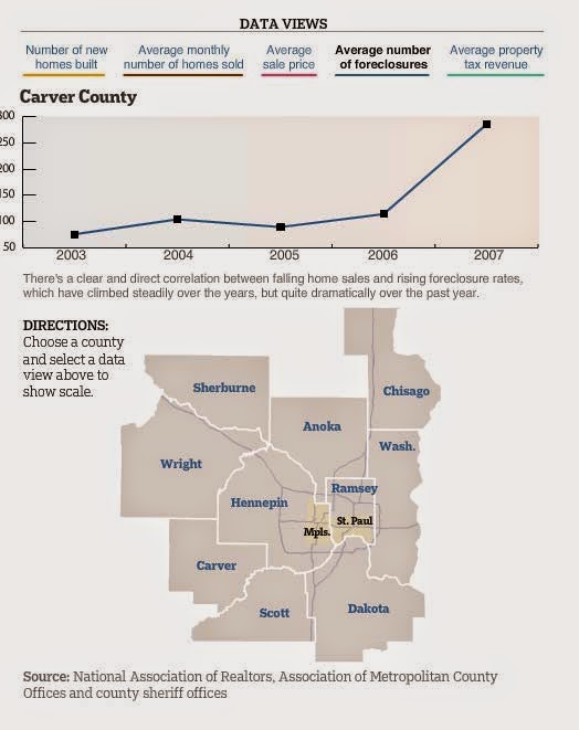
[Foreclosures in Carver County c. 2008]
8b.    There is little to no recognition of key local and trunk highway “A” minor and non- freeway principal arterial needs in the region.

Translation: OK I told you about my arterial needs, but you don't know how deep these run. We especially need wide new roads that go past still strip malls and brand new big box stores to replace the older empty big box stores. Oh, and have symbolic but unusable sidewalks.

    a.    Counties are truly Minnesota's subject matter experts when it comes to addressing poverty, and the causes of poverty. But these policy plans demonstrate no recognition of this experience and proficiency. Additionally, the plans contain no data demonstrating the effectiveness of the included strategies.

Translation: You don’t know me! Oh my god you have no idea what it's like to drive in this hellhole. CWADS exurban highway engineers know what’s best for us. They love us like a lover should, with wide new roads and park and rides that make us feel loved even if we never use them personally. Nobody knows us like we know ourselves. Oh yeah.

[Abandoned K-Mart in New Hope.]
10.a. The TPP does not recognize important resources suburban and rural counties contribute to improving and redeveloping the urban and urban centers and the entire region and State.
Translation: Where would Minneapolis be without CWADS and our resources? You know, things like… people who go to stadium concerts and ride on Pedal Pubs. How would the Coen Brothers make fun of their home town without a supply of suburban clichés about places like Normandale? Where would you put your Cabelas-es?
Item #11: The TPP should highlight the importance of advancing both transportation and recreational bicycle trails.
    a.    Counties and cities have worked for many years to develop a regional and local recreational trail system and have invested significant local and federal funds to these networks.
    b.    Many county regional trails provide both recreation and transportation, paralleling the county and State roadways, yet will not have equal standing when competing for funding. Regional trail networks make important connections to schools, community centers, parks, and activity centers that can be reached by bicycling and walking.

Translation: Why is everyone pretending that you can actually ride your bike to actual places (like the store, or school, or work)? It’s obvious that bikes are for riding around in parks for exercise on a Sunday. So why not lets just count all those bike trails along side the high-speed roads even though nobody is riding on them. Just please, please don't make us stripe any bike lanes. That would be silly.

[Average Carver County home: Norwood Young America.]
12a.    The minimum 20 dwelling units per acre for fixed/dedicated guideway exceeds FTA New Starts/Small Starts guidelines of nine to fifteen dwelling units per acre and is unrealistic for some transitway station locations. This requirement limits communities’ ability to consider input from their residents and market conditions.
    b.    If land use density minimums are perceived to be unattainable, land owners and some communities along transit ways could potentially resist new transitways and station locations and slow the region’s investment in new transit corridors.
Translation: Why do we have to build apartment buildings? That’s ridiculous! Nobody is going to do that out here, and having to pretend to try is going to put everyone in a bad mood. Like a seriously bad mood, you have no idea. Also, get off my lawn.

16.f.    The regional importance criterion favor projects near areas of high job concentrations but does not account for areas of projected regional job growth particularly in the suburban areas and beyond.
Translation: When we're doing planning and building transit systems, it's really important to be sure and count all the imaginary growth we planned in our heads when we platted our roads and political careers. Surely one imaginary corporate office park is worth at least 2/3 of an actual corporate office park? Can't we work on this?
[Cars in Coon Rapids = not enough roads.]
Item # 13: The TPP restricts certain types of land uses such as “surface parking lots” immediately around transit station areas.
    a.    While the logic behind encouraging higher densities, mixed use, and more walkable land use is sound, the prohibition of certain types of land use is overly restrictive.
    b.    Local land use planning decisions are a city/county responsibility that should be made by elected officials and should not be mandated by the Metropolitan Council

Translation: OK, this is the last straw. If we can't build surface parking lots next to park-and-rides and BRT stations, where can we put them? Also, "surface parking lots", as if there was any other kind of parking lot? We refuse to even acknowledge the distinction. If we can't pave it, it doesn't exist.

[An empty lot by a Northstar station in Anoka County.]

2014-08-04

MPR Decoder: Green Line Signal Timing

Occasionally, I listen to Minnesota Public Radio. So, occasionally, I share with you what I have heard in a segment I call MPR Decoder.

Here's last week's short Daily Circuit segment about signal timing on the Green Line. Host Tom Weber had on Brian Lamb from Metro Transit and Nancy Homans from the Saint Paul Mayor's Office to talk about the tension between the city and the Met Council over the stoplights of Saint Paul. Both officials stayed on message pretty well, even when Tom dropped a Chuck Marohn soundbyte on them (which the transportation policy equivalent of a bunker buster bomb). 

You can listen to it here, or enjoy this rough [slightly annotated] transcript:

[INTERVIEW BEGINS]

Tom Weber (TW): ... to the amateur observer [i.e. everyone with half a brain], it would seem a quirk makes this trip longer. It might be too late to change, but give us the theory... Why is it that stations were put after that stoplight vs. before, and now there are situations where there are two stops?

Brian Lamb (BL): When you’re taking the width of the street and trying to split the stations, if they were side by side it would further curtail the driving lanes ["curtail" is an interesting verb], so that’s why we have split stops.

TW: You have em right now where the stations are across the stoplights. But why not switch it? Why not have it be before the red lights, so that you’re putting the stops before the red light?

BL: Technically we do have the capability to reverse run [I like anytime a wonky professional drops jargon, like the "reverse run"], so we could run the westbound train down the eastbound tracks. However the system is designed that when we get the signalization optimized, and we don’t have it done quite yet [understatement], the train will go right through the intersection and only stop once. So therefore then it has a little more dwell time that's possible, on the far side before it leaves for the next station.

TW: So if it were before the stoplight and it turned green but the operator was loading passengers the train operator might feel pressure to say, c’mon!

BL: Exactly. You might miss another 90 seconds of the signal.

TW: So Nancy, the city has a big role here because the Green Line itself are operated by Metro Transit, but the lights are operated by the city. It sounds like its not working quite yet.

Nancy Homans (NH): We knew that from the get go, that once the system was installed it would take some fine tuning. It has to serve obviously automobile drivers, bus riders, pedestrians, bicyclists, folks who want to cross the intersection. [And in that order, too.] We made a commitment from the get go that the Green Line would not be a wall down the avenue that people would be able cross to get to the stores on the other side. So the challenge is that everybody gets the amount of time they need and everybody is well served and we are making those adjustments.

TW: The city … one of the debates is about "minor intersections" that the city could give up a little bit of its power to operate those lights and hand it over to metro transit so that it flows better. Is that gonna happen?


NH: What the Met Council and Metro Transit have asked is for us to consider signal preemption, which is that if the train is is coming it gets priority, at these intersections. We have indicated that we are willing to do that. [The "we have indicated that" is such a passive super political speak kind of phrase, isn't it. Like, "we have indicated we'll help you using a secret code akin to baseball signs where the managers scratch themselves on the ear..."] We need a little bit more comfort around some detection systems, but we are wiling to do that because we believe that if we can shave off a little time of those intersections, that the Snellings will work better. [“The Snellings" is like a nightmare I keep having, where I'm stalked by evil MnDOT engineers or something. Or maybe it's a horrible disease? "Looks like you've got a case of the Snellings. That's not going to clear up anytime soon."] 

But the challenge is that those intersections are green all the time unless someone has pushed the walk button to cross, or there’s someone waiting to cross [in a car]. So how those people are served or how a pedestrian is served... we want to make sure that those people aren’t skipped where they’re waiting and then wait for a train and then there’s a full 90 seconds or so before they get to cross. So we’re just trying to make sure we get that right.

TW: Is the goal and the meaning of the line to get people from downtown to downtown quickly? Is that actually the goal?

BL: As with many forms of transit, it has multiple goals. There are fewer people who will go the full length of the route from downtown to downtown, than people who... maybe the average length is a couple of miles... to go to a different part of the corridor. And that’s what makes this route so successful. 

By the way, we’re already over 30,000 riders per day, which is one of the most successful new starts in the country over the last several years, because it has that intermediate traffic. [More successful than the great Peoria express bus of 2011!] So it really has to serve people going long distances and those going short distances. 

For the most part those going downtown to downtown during peak they also have the option of the 94 express service. That bus is very successful as well.

TW: The solution sounds like you’re not saying "oops we made a mistake when we made the stations," [Britney Spears song?] but you’re saying that you’re saying you can fix what’s going on now simply by altering traffic signals. Is that correct?

BL: That is correct. We believe that with the proper signal balance b/w preemption and priority which is just the signal timing that we can keep the trains moving so that the only times the trains are stopped is when they’re picking up people. 

TW: So Nancy when will that happen?

NH: [She's not gonna answer that one!] We have a team of folks that are working on an intersection by intersection basis. So we will see improvement over time. We’ve already seen improvement from June 14th to today. And we expect to be working on this for months. And when new development and new transit are added we’re going to have to tweak it again. This is a continuous process of getting this right and we believe that when the signal timing is improved that will improve the ability of operators to predict that the lines going to stay green and they’ll be more confident going through the intersection. 

BL: And it is an iterative process as the signals get more synchronized we believe we can pick up the travel speed b/w the two stations and then it’ll cause another round of signal optimization. We’re at 33K before the U of MN or any other colleges are really in session, as the loads start to change that’ll be another opportunity to tweak the schedules.

TW: Nancy said we’re not gonna just make a wall and that the LRT is just going to go through untouched, its one of the things debated. Last month we spoke about transportation funding. Here's a short piece of audio from Chuck Marohn, of the organization Strong Towns... [Dropping a clip like this must be the best part of a radio host's job!]

Chuck Marohn (on tape): ... a billion dollar investment, yet we make it stop at red lights, how can you have a billion dollars dropped on a line and say "we’re going to make it sit here and let that cycle through when there’s no other cars around or there’s one or two other cars on a side street getting across…" If you’re going to make an investment of that size why would you not make it the priority of the corridor well the reason is that we’re sensitive to the notion of shaping behavior, telling people how we’re going to live. Well, we’ve done that. We’ve spent a billion dollars on this corridor, and I think we’ve gotta own the fact that transportation does shape behavior.

TW: Chuck is saying, "own it." You spent so much money, you should make it the only thing going through all the time, thoughts?

NH: We also added three additional stations so we could serve the communities that live along the line, that they were the people that needed to get to education and employment and stop for them. [Classic dodge, like a Dodge Aires or something.]

TW: That’s not the issue that chuck was saying. Chuck was saying, fine have as many stations as you want but just get ride of red lights. [Well done, Tom. Asking the follow-up question after a dodge must be the best part of a radio host's job. Actually there seem to be lots of fun parts to a radio host's job. I'm probably wrong about this.]

NH: In order to allow peds to cross University safely, we needed additional signals. We added those. As part of the design we involved thousands of people to help us understand how to do this best. 

But we agree, we need to get through more quickly and we are going to work day in and day out to reduce those signal impacts on the train, and give the pedestrian the appropriate amount of time, but at a different time and space to get through. We need to get the train down University Avenue and support all the amazing development that’s happening along the line, the 30,000 folks that are already riding, and the people that will be riding.  We understand our responsibility to that [with great traffic FUBAR comes great responsibility], and we think we’re working a very fine balance and we have partners at Metro Transit to help us get that balance right.

[Sounds good to me. Let's get it done, Saint Paul! The proof is in the train.]
 

2013-08-15

The All New Annotated Met Council "Streetcar Letter" to Minneapolis

[For original letter, see this article in the Pioneer Press. For previous parts of the "all-new annotated" series, see the annotated UMN "light rail" lawsuit, or these editions of the MPR Decoder

For a non-flippant actually-serious analysis of this situation, see my post on Streets.mn: Picking A Streetcar Fight with the Met Council is the Right Move for Minneapolis.]


July 12, 2013
Mayor R.T. Rybak
350 S. 5th St., Room 331
Minneapolis, MN 55415
Dear Mayor Rybak,
The City of Minneapolis is in the process of breaking new ground HAHA IT’S A PUN for the region’s transit system through its study of streetcar alternatives, in particular through the Nicollet-Central Transit Alternative Study. The City ... CHECK IT OUT, I’M GOING TO CALL IT “THE CITY” NOW, INSTEAD OF MINNEAPOLIS, LIKE IN A LEGAL DOCUMENT (PARTY OF THE FIRST PART, HERE TO FORE KNOWN AS “THE CITY”), AS IF MINNEAPOLIS IS THE ONLY CITY... has also taken the remarkable step of developing and seeking legislative authorization for a value capture funding source to help fund this project. Given the City’s active pursuit of a first-of-its kind modern streetcar project, I thought it would be helpful and prudent to outline the Metropolitan Council’s perspective on future development of this transit mode and regional investment. I.E. LOOK, I'M BEING HELPFUL. OOPS, JUST KIDDING... YOU’RE STEPPING ON MY TOES, MINNEAPOLIS.
The Council’s current Transportation Policy Plan (TPP) is nearly silent [CRICKETS] on streetcars as a mode of transit in the region, except for a reference to Council-local government collaboration to determine when and where a streetcar project might be appropriate.  KEY WORD HERE, MINNEAPOLIS, IS “COLLABORATION.” THAT MEANS WE SIT DOWN AND TALK AND THEN YOU PRETTY MUCH DO WHAT WE WANT. The TPP also states that projects that show a positive, significant, and cost-effective transportation benefit might be funded with local, regional and federal transportation funds, KEY WORDS: TRANSPORTATION BENEFIT, LIKE WHEN PEOPLE GO FROM PLACE TO PLACE. LIKE YOU KNOW EXAMPLES INCLUDE THREE LIGHT RAIL STATIONS IN A TINY CORNER OF BLOOMINGTON THAT NOBODY USES, OR A BRT LINE FROM THE MALL TO THE APPLE VALLEY ZOO OR LRT LINES THROUGH EMPTY PARKS, ETC but a project pursued primarily for development outcomes should be funded locally and should not compete with other priorities for federal and state transportation funds. THIS IS ABOUT THE MONEY, AND NONE OF OUR TRANSIT PROJECTS ARE FOR DEVELOPMENT, SEE? THEY’RE ALL ABOUT TRANSPORTATION, CALCULATED AND PRIORITIZED WITH THE GREATEST OF CARE TO TRANSPORT THE MOST PEOPLE MOST EFFICIENTLY WITHOUT MUCH THOUGHT OF DEVELOPING ANY LAND. With numerous transit corridors identified for future investment, the demand for transit capital and operating funding greatly exceeds current funding. I.E. WE’VE GIVEN YOU YOUR FRUIT BASKET, MINNEAPOLIS, AND WE NEED TO FOCUS ON PLACATING THE SUBURBS WITH LIGHT RAIL AND PROMISES OF AS-YET-NOT-SUCCESSFUL COMMUTER LINES.
Both transportation and economic development serve an important role in helping the region grow in an efficient, connected manner and provide justification for investment. I.E. ITS NOT LIKE WE’VE NEVER HEARD OF ECONOMIC DEVELOPMENT BEFORE… I understand that project justification for the Nicollet-Central streetcar is still under discussion by technical staff and policymakers as part of the Nicollet-Central Transit Alternatives Study. It will be important for the project justification to be well developed and vetted prior to it coming forward to the Council for consideration. I.E. … IT’S JUST THAT WE CAN’T TALK ABOUT IT EXPLICITLY IN PUBLIC FOR POLITICAL REASONS.
Work is just now beginning on the next regional TPP. I.E. ITS GONNA BE A WHILE. LIKE THREE YEARS. DON'T HOLD YOUR BREATH. We hope that the City of Minneapolis will play an active role in the development of the plan, allowing us to have a more robust regional discussion about the potential for developing streetcars as a transit option. I.E. WE’LL TAKE YOUR CALLS.
Because your project is proceeding more quickly than the next TPP, I feel it is important to proactively establish lines of communication and provide guidance on this project. SLOW DOWN THERE BUDDY, YOU’RE MOVING TOO FAST…
· Collaboration: Critical to the success of any project of this magnitude is collaboration between the Council and local units of government. ...DID I MENTION COLLABORATION YET? THAT MEANS WE MEET AND YOU AGREE TO STOP SQUEEZING OUR SHOES, OR AT THE VERY LEAST, TO GET IN LINE AND WAIT LIKE A GOOD LITTLE CITY. YOU CANNOT REPEL COLLABORATION OF THIS MAGNITUDE!...  In particular, if this project someday comes to fruition, we view it as critical that it be integrated into the existing transit system, regardless of how it is funded or which agency leads the implementation. LOOK, WE BOTH KNOW THAT WE’RE GONNA END UP RUNNING THIS THING. OUR DRIVERS, OUR LOGOS, OUR TRANSFER AND TICKET SYSTEM… It is necessary to include potential funding partners and other stakeholders (Hennepin County, MnDOT, Counties Transit Improvement Board) in this collaborative effort. COLLABORATION! It is also important for the City to understand that streetcars merit a regional discussion that results in a regional policy. As you are aware, the City of St. Paul is also actively studying a modern streetcar system and potentially looking to the region for policy guidance. LOOK AT SAINT PAUL. THEY’RE CALLING US. WHY AREN’T YOU CALLING US, MINNEAPOLIS? WHY YOU GOTTA BE LIKE THAT?

Funding: As our TPP states, funding for a project like this may be different depending on whether the project’s primary function is additional transportation benefits or development outcomes. At this point, both scenarios lack a clear funding strategy, such as those that have been used for light rail projects. I.E. GET THE FEDS TO PAY FOR HALF OF EVERYTHING AND HAVE A MONOPOLY ON STATE TRANSIT FUNDING. The Council anticipates that with any Locally Preferred Alternative forwarded for Council consideration, the City will also provide a funding plan that addresses both capital and operating costs and is consistent with the project’s primary function. KEY WORDS: OPERATING COSTS. The Council, the Counties Transit Improvement Board and the City should all be at the table when this funding plan is developed. The City should understand that if a streetcar does not provide a significant transportation benefit AND BY BENEFIT, WE MEAN MOVING PEOPLE TO AND FROM THE SUBURBS, the Council may not be able to prioritize the region’s limited transit funding for a project without a significant local contribution to both capital and operating costs. AGAIN I SAY, OPERATING COSTS. I.E. WE’RE NOT GOING TO RUN THIS STREETCAR FOR YOU UNLESS YOU PONY UP. The Council also appreciates the City’s efforts to support additional funding for transit that may OR MAY NOT expand the flexibility to include streetcar. WHEN WE SAY “APPRECIATES,” WE MEAN THIS IN THE MINNESOTA NICE SENSE OF THE TERM. LIKE, “I REALLY APPRECIATES IT WHEN YOU WASH THE DISHES RIGHT AWAY AFTER YOU MAKE A GIANT MESS IN THE KITCHEN.”

· Memorandum of Understanding (MOU): If the Council formally takes a position favorable to streetcars at some future point, the Council and the City of Minneapolis should seek to enter into a formal memorandum of understanding regarding the funding, design, construction, operation and maintenance of the proposed streetcar line. I.E. WE WANT THIS IN WRITING. While it is ideal for the Council to formally take a position on streetcar as a transit mode and on the prioritization of the many competing regional projects prior to entering into such a memorandum, we recognize that we may need to be flexible and utilize short term, limited scope memorandums between the time a Locally Preferred Alternative is adopted and the time the Council takes a formal position on street cars.  I.E. WE WANT IT IN WRITING NOW.

As you move through the Nicollet-Central Study and seek to recommend a Locally Preferred Alternative, I encourage the City to remain in regular contact with the Council. I.E. CALL ME! [MAKES TELEPHONE GESTURE.]

Cole Hiniker will function as your primary staff liaison. AND HE DOESN'T HAVE A SENSE OF HUMOR, CAPICE?.

This is an exciting possibility for our region and while there are many unresolved elements, the Council welcomes Minneapolis as an HYPER-active partner in the effort to expand transit options in the metro region. I.E. TAKE SOME RITALIN, MINNEAPOLIS.
Warmest regards, “SEND ALL MY LOVE TO THE MISSUS. YOU WOULDN'T WANT ANYTHING TO HAPPEN TO YOUR NICE FAMILY... [PATS MINNEAPOLIS ON THE BACK]”
Susan Haigh
Chair

CC:
Counties Transit Improvement Board
Mayor Chris Coleman, City of Saint Paul
Commissioner Peter McLaughlin, Hennepin County
Commissioner Charlie Zelle, Minnesota Department of Transportation OOPS, I FORWARDED THIS TO ALL THE PEOPLE WITH THE MONEY.

[The Met Council's pedestrian friendly office in downtown Saint Paul.]