Leave guesses in the comments, or email me at blindeke
 You know what? The sidewalks are really interesting right now. All those snowdrifts, snowbanks, the mounds of white black grey dirt melty freezy crustslush that have been lining the sidewalks since November are melting, and depositing their secret treasures all over the sidewalks. Coke cans and gum wrappers that were dropped or carelessly tossed aside on October have been cryogenically frozen in snowbanks all winter long, and now they're finally seeing the light of the sun again for the first time in months.
While I appreciate the particularly Minnesotan cul de sac criticism, being hard to plow is just the tip of the snowdrift when it comes to culs-de-sac and their problems.
Here’s three big reasons:
- They’re a pedestrian wasteland. Culs-de-sac, and the sprawling, disordered, difficult to navigate neighborhoods that follow them, are too non-linear to easily have sidewalks. Even if they had them, it would be too difficult to walk anywhere, and the lack of any commercial streets mean there’s nowhere to walk anyway. For a country facing an oil-induced energy crisis, this is a problem.
- They can increase traffic congestion. Because culs-de-sac aren’t through streets, they force all the cars onto one or two main drags. Increased traffic levels often mean congestion, and without any alternative routes, there’s nothing PO’d drivers can do about it.
- Culs-de-sac aren’t safer. At least one study has shown that the “quiet and child-friendly” cul-de-sac is statistically more dangerous. Parents, constantly forced to back out of their driveways, are very likely to back over one of their own (or their neighbor’s) children. In addition, the lack of regular traffic (or neighbor’s windows) on the street makes it more likely for a burglary to occur.
 Your other sidewalk blog of the week is:
That's why his group and the Minnesota Auto Dealers' Association have courted ethanol producers and agriculture powerhouses like the Minnesota Corn Growers and the Farm Bureau to join the fight being waged in Minnesota and eight other states over whether the federal Environmental Protection Agency (EPA) in Washington, D.C., or the California Air Resources Board (ARB) in Sacramento should be the guiding authority on regulating auto emissions.
I like how "walkable" is in quotes. Someday, I have faith that it'll be a real word!
In an effort to make Minneapolis more "walkable," city officials are working up a pedestrian master plan, which they hope will ultimately improve the safety, accessibility and beauty of problem areas.
The process goes like this: The city holds public open houses, the first of which is today, where people can point out pedestrian challenges. Those challenges should lead to recommendations. Those recommendations will be drafted into a plan and presented to the City Council in the fall.
Already, drivers, bicyclists and pedestrians are putting in their two cents about potential improvements.
 Potholes are the new black!
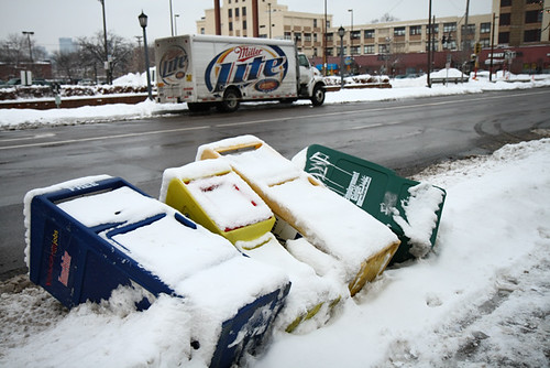
 You might remember that a few weeks ago, Prevention Magazine inexplicably ranked Minneapolis the #70 "Best Place to Walk in the U.S."
 Cities with high income, a lot of tourists, or good weather are far more likely to have people who walk for "fitness", rather than people who walk because they need to. And cities with higher total numbers of pedestrians are far more likely to have more pedestrian fatalities overall. For example, a very unwalkable city would probably have very few pedestrian fatalities, simply because nobody would ever walk in it.
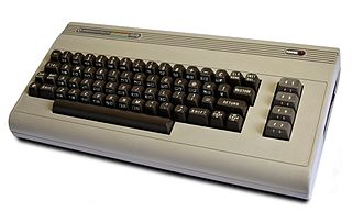 [Little known fact: The Prevention Magazine Walkability Rankings were created on a Commodore 64.]
The authors examine the magnitude of health benefits from urban design characteristics that are associated with increased walking. Using geocoded travel diary data from Portland, Oregon, regression analyses give information on the magnitude and statistical significance of the link between urban design variables and two-day walking distances. From the coefficient point estimates, the authors link to the health literature to give information on how many persons would realize health benefits, in the form of reductions in mortality risk, from walking increases associated with urban design changes. Using a cost-benefit analysis framework, they give monetized estimates of the health benefits of various urban design changes. The article closes with suggestions about how the techniques developed can be applied to other cost-benefit analyses of the health benefits of planning projects that are intended to increase walking.
Most the of the communities where Americans live are important contributors to current public health problems. Simultaneously, they can also be the source of important solutions to these problems. Communities can be designed to make physical activity in them possible and even desirable. Environments that encourage moderate physical activity may also have features that make them more liveable in other ways, by improving one's quality of life -- they may generate more social interaction, foster less dependence on the automobile, be safer for their inhabitants, and give people more choices with respect to how they get around and spend their time. In these pages we do not seek to condemn any particular form of community design. Rather, a central goal is to develop a better understanding of the ways in which the features o the built environment serve to encourage or discourage health -- promoting behaviors, two of which are walking and bicycling.
On the first day of my walking regimen, I slipped into hiking boots and filled a backpack with various work papers and skin lubricants. It was March, so nobody was outside. Nobody who wasn’t in a car, that is. A recent survey asked Minneapolis residents to list their primary mode of transportation; seventy-four percent travel by car, sixteen percent by bus. Only two percent listed each bicycling and walking. That’s not so surprising when you consider other city statistics, which show that the total number of “vehicle miles traveled” increased 129 percent between 1970 and 1990, and that since the 1950s, more than five hundred miles of highway have been constructed in the metropolitan area.


 It might not look like it, but there's a small world hiding on this one little corner of Randolph and Hamline Avenues in the middle of Saint Paul.

 So the Catholic school across the street explains the Catholic Books & Gift shop. But then you've also got Kopplin's Coffee Shop, home of not one, but two Clover coffee machines, and these two little stores occupying a pair of symmetrical butterfly-wing doors that open onto this little stretch of sidewalk.
 Sidenote: Perhaps this is a good time to question the Saint Paul convention of identifying neighborhoods by juxtaposing the first syllables of the nearest intersecting avenues. E.g. The "Ran-Ham" neighborhood, a name that rolls off the tongue like previously chewed fudge?

 Careful out there Twin Cities! Just when you think the sidewalks are finally free of snow, and you can move along to mudpuddles and earthworms, along comes more drifting slush.
Still, there are several challenges ahead. First, we need to get the counties to join the JPA. Second, we need to move the Central Corridor light rail transit line forward with $70 million in General Obligation bonds this year and another $30 million in the 2009 legislative session. Third, we need to protect the current general fund allocations to transit.
"Mainly, I hate being in a car," Avidor said. "It's a canned experience."
"All this space, and there's no bike stand," he muttered as he and Singer wheeled away from the front doors of the convention center to look for a pole to lock their bikes.
"The formaldehyde new car smell," said Singer as we walked into the convention center's biggest event, a half-million square feet of exhibit space covered with gleaming sheet metal.

People in city halls who have been processing thousands of building permits are losing their jobs. Cities such as Woodbury and Cottage Grove are reassigning staffers from approving developments and inspecting new homes to keeping an eye on those abandoned in mid-construction -- watching for graffiti or burst pipes.
On Sunday, Roadguy was walking along this stretch of bombed-out asphalt, and near the intersection with Aldrich, he spied something green amid all the broken gray: a 10-dollar bill.
I looked around, picked it up and contemplated my next move. Leave the money in the road in the hope that the owner might return for it? Put it back so another random person could have it, or so it could blow into a puddle and/or get run over?
As I ruminated, the friend I was with spied a one-dollar bill nearby. It was folded similarly, and it came with a clue: A receipt from Target.
 I mean, listen to this crap!
Watch your footing out there - the sidewalks are nothing but ice. At least in the neighborhoods. But instead of condemning people for not shoveling the public sidewalks in front of their houses, I urge everyone to enjoy this early December icing. Because if we are all lucky enough to reproduce and then have offspring able and willing to do the same, we can tell our grandkids these great stories like:
"I remember back in aught-seven when we got four inches of snow December - early December! And you know there was ice all over the place - frozen water, I tells ya!"[...]
 I was sad to discover an awesome website, only too late. While up on Central Avenue recently, I saw the new NorthEast location of Porky's Diner, the famous University Avenue car 'n' pork joint, which is apparently hedging its bets before the impending Light Rail train for better, more auto-oriented climes to the West.
1. St. Paul Porky's had high levels of police calls, crime, and nuisance issues compared to comparable businesses. St. Paul police: "(Porky's) proved to be undependable."Why is there a big difference in my mind between Burger King and Porky's? Hell, I like Porky's! And, if these folks think they have it bad, imagine being a resident of the nursing home that is next to the Saint Paul Porky's? (I've always thought that was strange, even though the pig joint came first.)
2. Land use: the new Porky's neighbors single family homes and the drive thru exits 40 feet from the front door of the adjacent home.
Consider where new fast food restaurants are being built; typically, new fast food restaurants are situated away from homes to minimize the effects of high traffic level and loudspeakers.
3. Land use: the lot of the new Porky's is too small: 1/3 acre. The St. Paul Porky's has about an acre and most other fast food restaurants lots that are .75-1.25 acres.
4. Land use: The Porky's lot and neighboring public land needed to be rezoned to allow Porky's to develop. The zoning code is a contract between residents and the city, so both sides know what kind of development can occur. If a parcel of land is rezoned, it is normally agreed to by the residents and city. In this instance, the adjacent neighbors views were ignored. Who will be ignored next?
5. Inconsistent development principles: other businesses proposed uses for the site that required rezoning, but the city and council member quietly rebuffed the proposals. For the Porky's proposal, the city rezoned the adjacent public property to allow Porky's to build.
6. Near another problem fast food restaurant: neighbors regularly complain to the city regarding the Burger King 1 block south. Yet, the city has not adequately monitored that site. Can the city manager to monitor another fast food restaurant?


Keith Koch just went ahead and paid out-of-pocket for the new public patch of sidewalk in front of 926. No threatening to leave town. No referendum. But then Keith didn't have much choice. A while back the city ordered him to pull a permit within 15 days and hire a licensed and bonded contractor or it would bid the job out, add a 10-percent fee on top of estimated costs of $500, and put the tab on Keith's property taxes to be paid over five years at 6 percent.
This isn't just any sidewalk. It's the last section of public walkway on the eastern shore. Five feet further on is an 8-foot chain link fence. Beyond the fence, southbound 35W splits into three lanes heading for 94 East, 94 West, and the 11th Avenue exit; four lanes of 94 head east with one lane peeling away to 55 South; four more lanes of 94 head west with two unopened lanes coming in from northbound 55; three lanes of 35W head north with one lane splitting off for the Third Street exit; the Fifth Street exit comes in from 94 West; and the Sixth Street ramp heads out for 94 East. Altogether you need to leap the fence, sprint across 16 lanes of freeway, climb a hill, leap another chain-link fence, and cross a street before you land on the next section of sidewalk on 13th Avenue.
Metro Transit bus, train fares likely to increase
By Dave Orrick
dorrick@pioneerpress.com
Article Last Updated: 03/19/2008 08:57:59 AM CDT
A possible $47.5 million hole in the budget of the Metropolitan Council will likely lead to fare hikes on buses and trains at a time when ridership is booming, the agency's top official said Tuesday.
Peter Bell, Pawlenty's chairman of the Metropolitan Council, offered up a bleak picture of what could happen if Pawlenty's proposed budget cuts to Metro Transit were to come to fruition.
Bell offered a PowerPoint presentation that showed Metro Transit will be running a $1 million deficit in fiscal year 2008, and a whopping $28 million to $40 million in 2009, if all revenues and expenses stay as-is. "How did we get to this point?" one slide in the show asked. Some answers, among many, were a decline in the motor vehicle sales tax forecasts, commitments to funding the Northstar commuter rail line and, at the end, "Governor's Budget Cuts."
... the Feds, Bell admitted, won't take too kindly to increasing fares and cutting services.This is on top of the fact that current versions of the state budget don't adequately fund the state's portion of the Central Corridor. According to a source, both Pothole Pawlenty's budget proposal, and the DFL version of the same fund $70 million for the Central Corridor project, half of the required amount to guarantee federal dollars.
"The FTA will not fund any transit expansion if we degrade our bus system," Bell told committee members. "If we are raising fares and cutting routes ... they will not fund 50 percent" of the costs for these and other projects. Which means delays, if the projects ever happen at all.
So for now Bell and lawmakers are looking for other solutions, partnering with counties for funding and the like. But perhaps just as startling as the money issue was Bell's seeming willingness to go against the grain with the governor; he's long been viewed as a Pawlenty acolyte.[emphasis mine]


 you to try the skyline chili, a local mix of spaghetti, chili, oyster crackers, and tons and tons of shredded cheese. Similarly, the city’s slogan – “The Queen city” – is everywhere, as are barges and paddleboats and bridges and fans of the local baseball team. (Not only that, but the Twins and the Reds have long been joined in a kind of vampiric symbiosis, as their two General Managers had worked together and arranged a great many trades for some of the most mediocre players in the majors, like Kyle Loshe and Luis Rivas. [shudder])
 [Three views of fountain square, one of them flattering. The fountain is very nice, though. It spouts water in all sorts of ways from a great variety of cast iron figurines. One of my great problems with Fountain Square is that its not demarcated; its almost as if the street extends right into the middle of the square, and you can easily imagine some dude in an SUV just driving all over this piece of pedestrian pavement. It compares quite unfavorably to Saint Paul's Rice Park, for example.]
 The city was apparently trying to liven up its square. They were hosting events, and had installed a giant rectangular TV screen above the facing Macy’s. The screen was largely illegible during the daytime, and screened a constant ‘big brother’ feed of the square, as if to say “you’re being watched.” But during the evenings, they were using the screen to show movies to the public, and I guess it’d be fun to watch a film there if you enjoy the visual experience of a drive through. It's certainly an attempt to move in the right direction, to recreate some life on the city's sidewalks, even if a few neck-craning details had been overlooked. But Fountain Square was far too institutional and alienating for me, even though the fountain itself is very nice.
 [A scene that will be familiar to any Twin Citian: a map and skyway, only here it lurks in a city that doesn't even have winter to speak of.]
 Cincinnati is also one of the few cities in America, save for our very fine Twin Cities, that can boast of a skyway system. I’ve often complained (and I will again) that our skyways are a soul-sucking blight on our downtowns, feature the worst kind of public space, and represent not just a stratified class system but reinforce a veritable fear of the out-of-doors, but at the very least we have a dozen or so cold winter days to justify these lifeless bridges between buildings. In Cincinnati, they don’t even have snow! It might be a bit hot, climate-wise, but if you ever want to see a place whose streets have been destroyed by skyways, go to Cincinnati, Ohio. It’s like an entire downtown of nothing but Town Squares and City Centre’s, Galtier Plazas and Pillsbury HQ’s. Most of the office buildings host interior atria, like this one in the gargantuan Westin Hotel,* where everything closes at 5 pm and boasts all the ambience of a high school swimming pool.
 [Aaah, the pleasant experience of walking to the riverfront.]
 Cincinnati also has a legacy of terrible freeway placement, and auto-oriented streets. The interstate, I -71, runs directly between the downtown and the Ohio River, which, quite frankly, kicks the Mississippi’s butt when it comes to being a large, impressive river. (Our river might have a nice name, but it carries less water than the Minnesota, Missouri, Saint Croix, or Ohio…) And the large freeway makes it difficult, unpleasant, and boring to actually try and walk down to the riverbanks, to attempt to enjoy the wide muddy vistas between Ohio and Kentucky. The freeway in the way means that anyone trying to find the water has to explore the undersides of massive overpasses, spelunking along sidewalks that run under cars, along mesh fences. The riverfront itself is concrete, and there’s not much down there except the two massive stadiums that the city has no doubt subsidized to the gills, and a museum devoted to the African-American experience.
 [Four scenes of the riverfront area, and how it makes life difficult for those on sidewalks. Everything's out of scale. Everything's concrete. Imagine walking around here at night!]
 It’s a shame that Cincinnati's riverfront is so dominated by pro sports, too, because the city’s bridges are wonderful to walk across. There are a number to choose from, leading from Ohio to Kentucky, but the one that everyone should walk on is the purple people bridge, a pedestrian-only walkway bridge that carries folk from Downtown Cincinnati to Newport, Kentucky. Now, Newport is a place that’s has one of those new suburban potemkin downtowns, like Maple Grove or Woodbury, with little shops lining a very walkable sidewalks along the riverbank. Every local that I talked to in Cincinnati told me to go down here, because it was nice, and because its practically the only place I ever went where I saw people from the suburbs enjoying themselves. If anything, Newport serves as an example of what the rest of the city could look like if they ever pulled their sidewalks out of their modernist asses.
 Finally, a few folks told me that Cincinnati has a lot of corporate headquarters (a boast exactly the same as a common Twin Cities meme). But the one that I found, Procter and Gamble, sat on the edge of downtown like a fortress, surrounded by gates and concrete and giant parking lot moats. All in all, there were precious few sidewalk-friendly features in downtown Cincinnati, and from my street-level view, it seemed that most of what the government was attempting to do was having negative effects, making the walkability problems even worse. (The same holds true for the massive Kroger HQ.)
 [One of the main streets of Cincinnati, Ohio, where people wait for the bus and admire the 60s architecture.]
 No, the big difference between Cincinnati and the Twin Cities is that Cincinnati is far far older than Saint Paul or Minneapolis. In fact, Cincinnati was the first non-coastal boomtown in America,** and peaked sometime in the early- to mid-1800s with a flood of German immigrants crossing the Appalachians to get to the very-navigable Ohio River. Cincinnati boasted large populations of people who, at one time slaughtered more pork than anywhere in the world (Cincinnati named itself “porkopolis”). And today, Cincinnati has the largest contiguous historic district in the country in the Over-the-Rhine neighborhood. I’d read about Over-the-Rhine on historic preservation websites: it was a huge area of old buildings next to downtown Cincinnati, and had recently been given, en masse, historic preservation status. It was named after the old Miami and Erie Canal that had run from the Ohio River and around downtown, which the German immigrants had taken to calling the Rhine River as they crossed it to go to work every day.*** So one Sunday morning, I set out to find it.
 I found myself entering the Over-the-Rhine neighborhood somewhere near York Street north of Liberty, and of all the cities I’ve wandred in, I can say that I’ve never been more blown away by the beauty of the old buildings. This part of the country has huge amounts of in-tact turn of the century hosuing stock… row houses with Victorian elegance, woodwork, porticoes and cornices, brickwork and bay windows, porches and stoops. I’ve also never been more blown away by the decrepit conditions of the houses I saw, as I wandered for miles through the Over-the-Rhine neighborhood. I was solicited by a nice lady on a Sunday morning, nobody was out and about, and I didn’t feel like it would have been very ethical to take many photos of this part of town.
 [Findlay Market, a quite nice place to buy a canteloupe, or sit on the stoop. Unfortunately, its the only nice place to do such things in the entire Over-the-Rhine neighborhood, as far as I could tell.]
 The buildings in the neighborhood, just any of the buildings in Over-the-Rhine, were gorgeous three story brownstones that wouldn't be out of place in San Francisco, and the entire experience would have been like going back in time and stepping into a postcard, if all the houses along the streets surrounding the market hadn't been boarded up. I've had similar experiences in places like Memphis or Baltimore, where small parts of the city are somewhat renovated and surrounded by bombed out houses... but I felt like the social and economic activity in Findlay Market was primarily oriented toward the community that lived there, if only because I didn't think anyone else in Cincinnati would have been willing to come down to the Over-the-Rhine and frequent the marketplace.
 (Don't get me wrong, there are people living in Over-the-Rhine, but I've gotten this far in this entry without mentioning Cincinnati's rather tragic history of race relations, and I 'd kind of like to keep the focus on the buildings. Here's a link to a video which I think reflects well the social conditions of the Over-the-Rhine, and its problems with relating to greater Cincinnati.)
 [Buildings like this are very hard to find in the United States of America.]