 I published a column this week in Cityscape all about the urban "open data" movement. I'm kind of averse to what JH Kunstler calls "technonarcissm," but the open data movement seem to me a more compelling kind of interaction between the public and government. As I put it in the piece, "open data is a movement that combines government transparency, bottom-up crowd sourcing, and high-tech geekery into an unpredictable stew of numbers."
Here are some other ideas that didn't make the final cut of the piece...
Data is Valuable
One of the key points that I wish I could dive into more fully is about how much money data is worth.  |
| [Nice Ride data viz.] |
Meanwhile, Nice Ride is just dumping their data out into the public realm for anyone to use. Good on them!
Similarly, the conversation with Andrew Own made me realize how progressive and helpful cities could become if they actually went out and generated particular data, rather than passively making their currently existing data available.
For example, if Minneapolis actually proactively generated a speed and traffic data set (that Owen fantasized about), they would have an amazing resource that I and many people could use to think about the connections between street design, speed and safety, and traffic flow. That could be a game changer for Minneapolis, but it would take active cultivation form the city to make it happen.
 |
| [Traffic accidents in New York City.] |
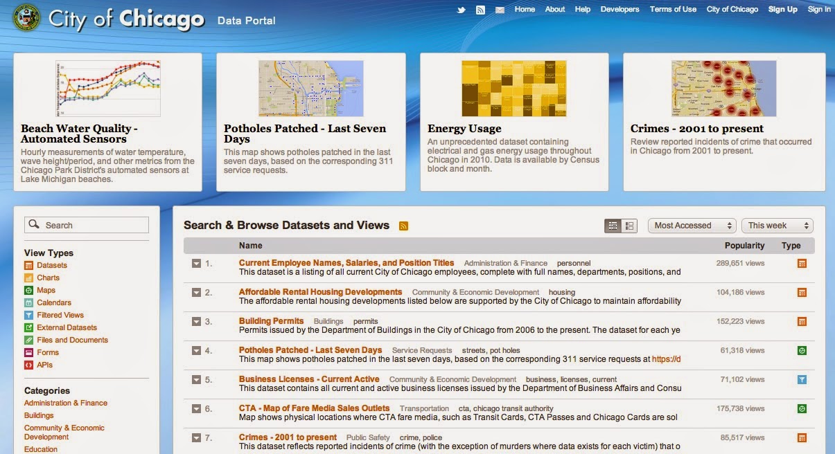
The Role of the Portal
 |
| [NYC even has a data viz of their data sets.] |
Having an open data portal for cities, kind of like a homepage for metrics that show trends throughout the city. For example, it could show violent crime, weather patterns, foreclosure rates, average traffic counts, accident rates, etc.
If Minneapolis' portal looks half as good as New York's or Chicago's, it'll be amazing. Imagine all this data in one place? Imagine being able to look up taxable land values so that you could make your own "Taco Johns" analyses, easily find ADT maps, crime comparisons for neighborhoods, look at street tree cover, or whatever else you can imagine.
For one thing, it would make you realize exactly how much the city government is doing at any given time. Often, the role of the government fades into the background. City services disappear like sewers, and people end having very little idea what their tax dollars are actually doing all year long. A data portal like the one that New York has reveals all of that activity, putting it all in once place where anyone can see it.
Frankly, it's amazing to see so many different activities gathered in once place. It reminds me of a 21st century version of the old "city symphony" films, which attempted to reveal and narrate the complex working of the city through documentary documentation. (The best of these is the famous Man with a Movie Camera.)

 Following Through and Two Saint Paul Example
Saint Paul should follow Minneapolis' lead, obviously, as should the rest of the cities in the metro. According to one of my sources for the piece, Saint Paul makes shape file data available for all their storm drains. (Though I can't personally find such a map anywhere on the city website.)
Why is this helpful? Because when streets ice over and flood in the early Spring, people know exactly where to go out onto the street and break up the ice to make sure the street drains properly. I mean, it's not something that I particularly care about, but
Saint Paul also has an adopt-a-hydrant program that got some press a while back. One of the dangers about open data hype is that follow through becomes very important. Even if you make an app that does something interesting, if people don't actively promote and disseminate the program, it's not going to do much good.
Who Knows?
Probably the most exciting things about the open data idea is that I can't even being to predict what might happen. I have no idea how many data sets there might be out there. And I have no idea what the increasingly data-savvy public might do with these various data once they get their nerdy hands on them.
Stop signs per capita per neighborhood?
A map of street lights correlated with income?
A map of snow plowing plotted against political contributions?
A dramatic pothole vizualization animation?
Crosswalks bollards per city ward?
Average traffic speed plotted against land values?
A map of freeway noise?
Toilets flushed per person per hour per neighborhood?
 |
| [Energy use map of Chicago neighorhoods.] |
No comments:
Post a Comment